Every child loves an outdoor adventure and you're sure in for a treat! Our World Heritage National Parks, gardens and waterways will have you coming back for more, year after year. There are amazing and easy to access walking trails, breathtaking lookouts and waterfalls that cascade into clear mountain pools. Surrounding the ancient Mt Warning (Wollumbin) volcano are the natural treasures of the Mt Warning, Border Ranges and Nightcap National Parks and the last eleven remnants of “The Big Scrub”, the vast rainforest that once blanketed much of the region.
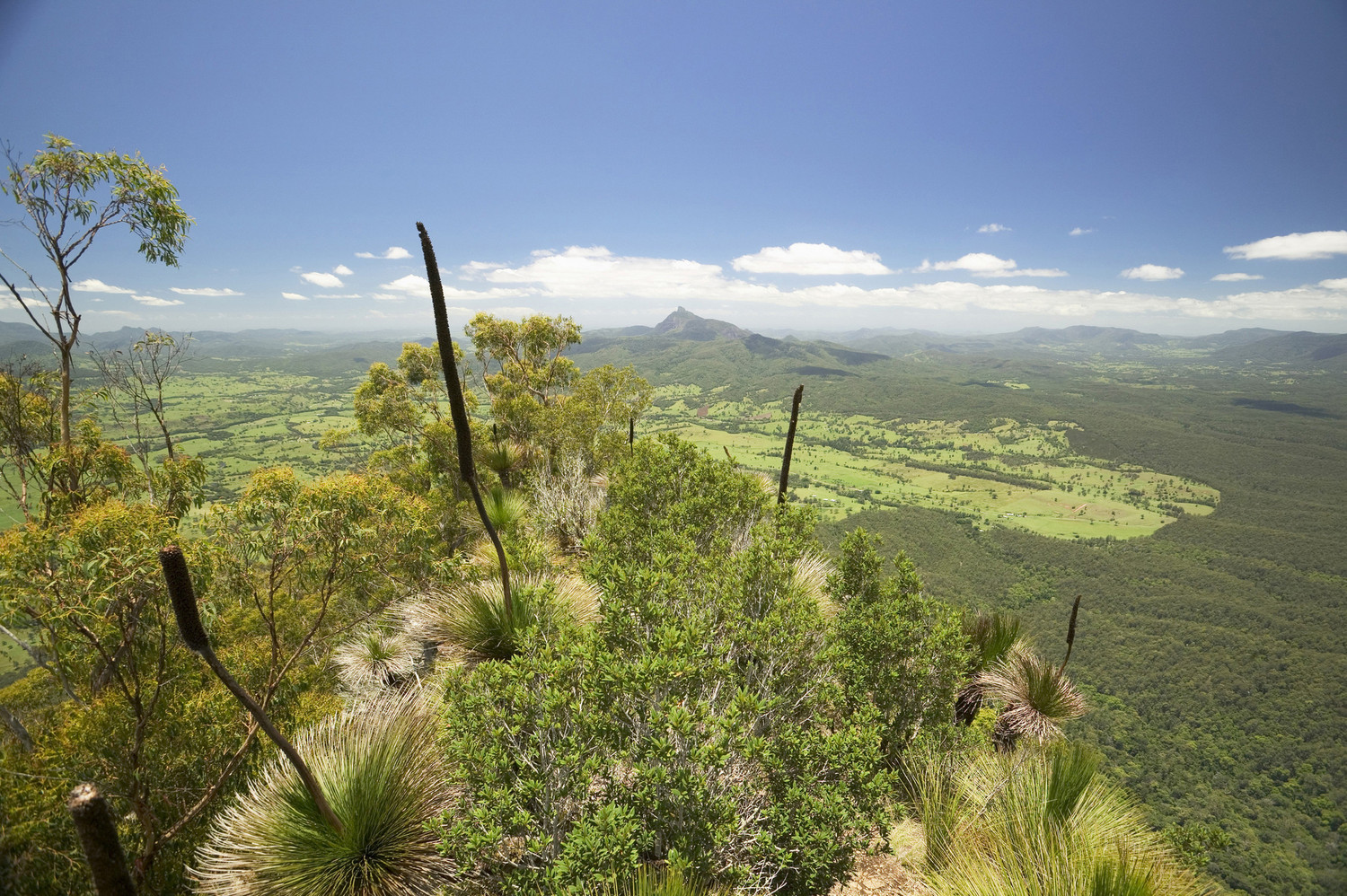
Border Ranges National Park is a large area of wilderness that protects untouched rainforest and unique plants and animals connected to the ancient supercontinent of Gondwana.
There are spectacular views, tall forests, waterfalls, gorges and pristine rainforest walks. Explore the abundant wonders of the rainforest hidden throughout this rare haven.
The amazing view from The Pinnacle Lookout is a highlight of any visit to the park. Looking out from the caldera with the lush Tweed Valley over 100m below, and views over Wollumbin across to the ocean and beyond, is to experience one of Australia’s most breathtaking natural wonders. There are walking trails to suit all levels. Try the short Palm Valley loop walk through subtropical rainforest or take the more difficult Booyong walk that leaves from Sheepstation Creek campground. You’re bound to find a beautiful spot for a picnic or barbecue lunch. Photographers will love capturing billowing waterfalls, views of Wollumbin-Mount Warning and lush rainforest plants.
For opening times, fees, weather & climate information, maps and up to date access and road conditions see the National Parks website here.
38 km west of Murwillumbah off the Kyogle Road via Barkers Vale or 28kms north of Kyogle off the Summerland Way.
> bar mountain circuit
> border loop walk
> brindle creek picnic area
Content and image provided by 'NSW National Parks and Wildlife Service'.
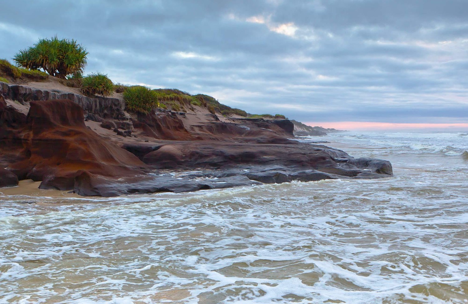
If you enjoy holidaying on the water, you’ll love Bundjalung’s combination of river, beach and freshwater lagoons. This north coast park stretches north from Iluka to Evans Head with the Pacific Ocean as its eastern boundary.
Spend a day canoeing along Evans River or Jerusalem Creek, mountain biking the Macaulays Lead or Serendipity fire trail, or walking along Ten Mile Beach. There are also boat launching facilities, snorkelling on the shallow reefs and fishing.
If you’d like to spend longer exploring, head to one of the beachside campgrounds in the park, or book into one of the Woody Head cabins. In the evening enjoy a barbecue dinner before gathering around the campfire with a local Bundjalung guide to listen to stories of their culture, values and connections to this park.
For opening times, fees, weather & climate information, maps and up to date access and road conditions see the National Parks website here.
50 km south of Ballina. Turn off the Pacific Highway onto Iluka Road.
> Canoe Evans River paddle route
> Esk River paddle route
> Iluka Bluff lookout
> Jerusalem Creek Paddle route
> Jerusalem Creek walk
Content and image provided by 'NSW National Parks and Wildlife Service'.
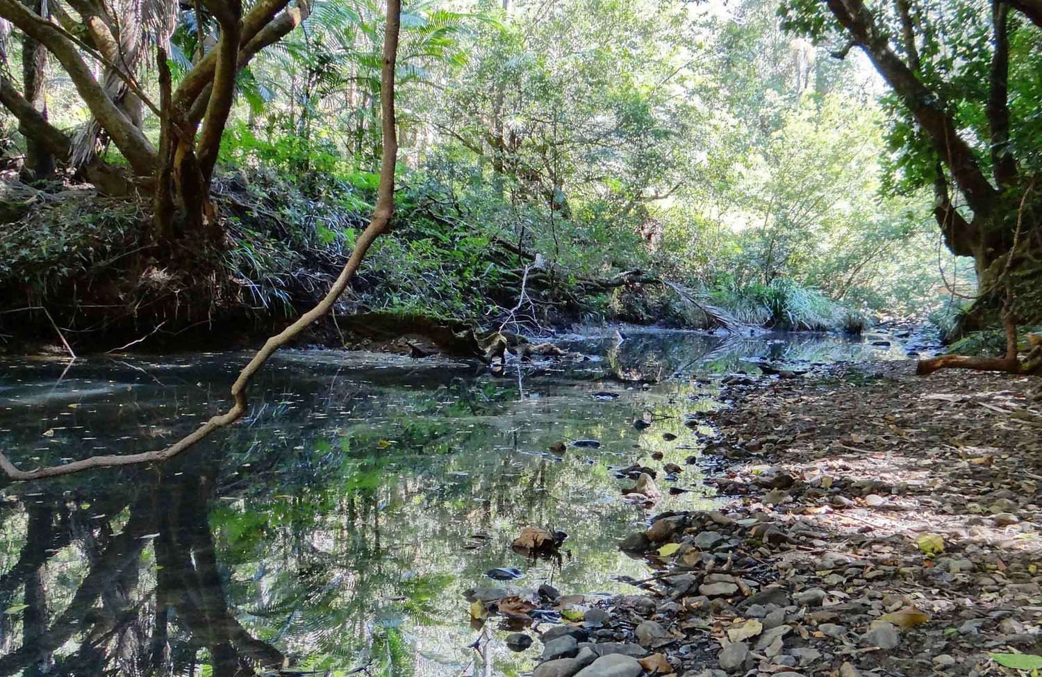
“The last time we were here, we lay on our backs under a large eucalyptus tree listening to a pair of beautiful black cockatoos chattering in the branches above us.” Near Murwillumbah and Tweed Heads, Mebbin National Park is a paradise for nature-lovers.
It’s a significant nature conservation area, which protects an important part of the Tweed landscape while also serving as a vital habitat link between the World Heritage areas of Wollumbin and Border Ranges National Parks.
A large portion of the park is dry eucalypt forest, with some rainforest and a small section of old growth forest. Explore the park’s lush environment by following Byrrill Creek walking track through sub-tropical rainforest and fig trees. Or, enjoy mountain biking or horseback riding along the trails that wind under towering eucalyptus trees.
Along your way, be sure to keep your eyes open for glimpses of some of the park’s rare, threatened species, such as large owls, lace monitor lizards, glossy black-cockatoos, and red-legged pademelons. The endangered giant barred frog is rarely seen, but may be heard calling out across the park on hot summer nights.
There are pleasant areas for camping and picnicking at Cutters Camp campground. Set in a lovely forested setting with free wood and gas barbecues, the campground is popular with families, birdwatchers and bushwalkers alike.
For opening times, fees, weather & climate information, maps and up to date access and road conditions see the National Parks website here.
From Murwillumbah take the Kyogle Road through Uki, then turn right into Byrrill Creek Road. From Byrrill Creek Road turn left into Mebbin Forest Road which leads to the park boundary (about 1 kilometre), and a further kilometre into Cutters Camp. Take Brays Creek Road south from Tyalgum and turn left into Byrrill Creek Road. Keep going until you reach Mebbin Forest Road, which will take you 1 kilometre to the park boundary and another kilometre into Cutters Camp campground and picnic area.
Road quality: unpaved sections
> Byrill Creek walking track
Content and image provided by 'NSW National Parks and Wildlife Service'.
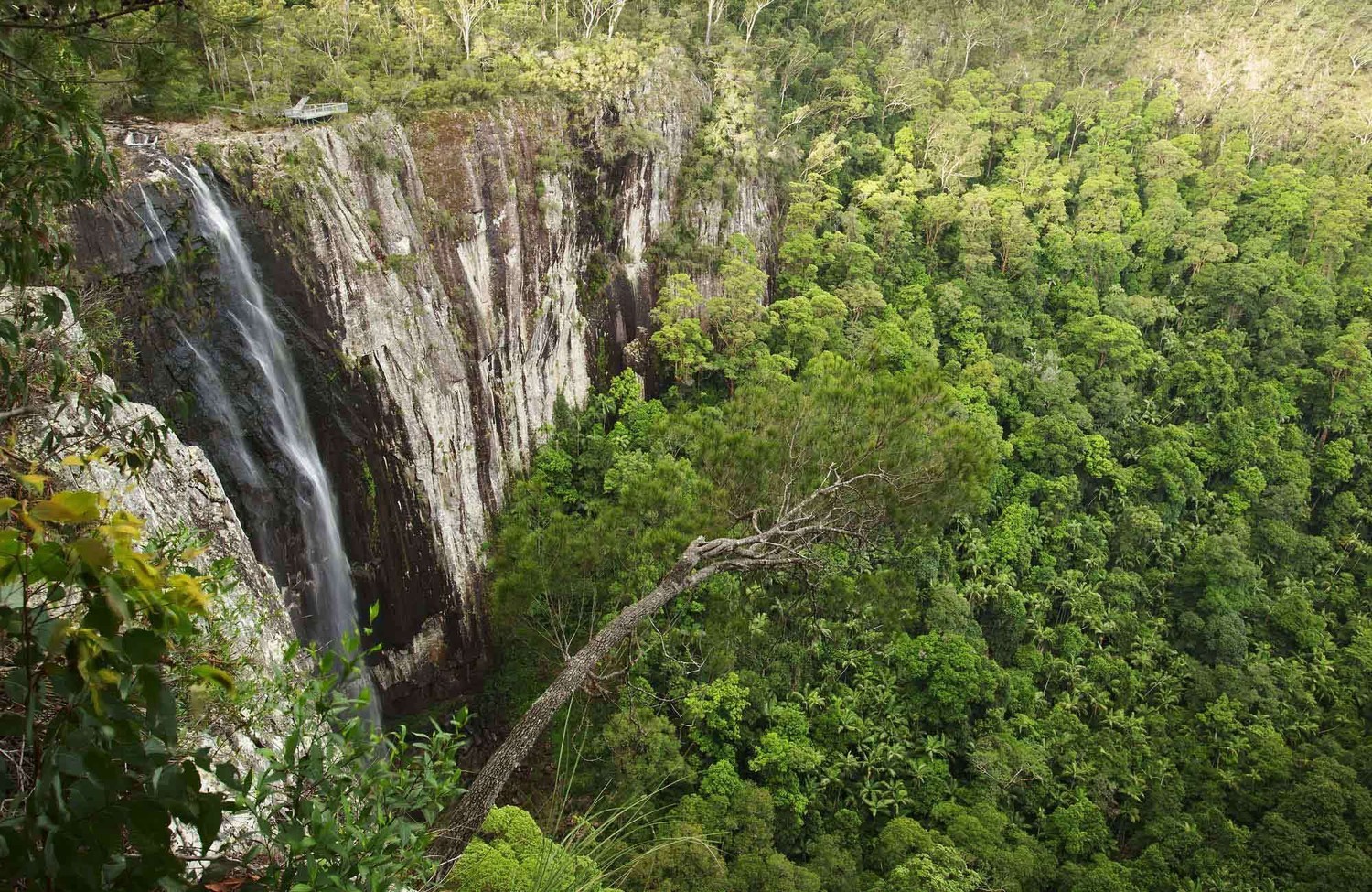
Walking in the rainforests of Nightcap National Park is like entering a timeless landscape – it’s an unforgettable place. Nightcap National Park, part of the Gondwana Rainforests of Australia World Heritage Area, is a dramatically beautiful park full of ancient rainforests, magical waterways and spectacular views.
The lush rainforest provides a home for the newly discovered nightcap oak as well as a number of threatened animal species, including Albert’s lyrebird and Fleay’s barred frog which takes shelter under leaf litter and makes an ‘ok-okok-ok-ok’ after rain.
With easy access from Lismore and Nimbin, you can enjoy a picnic, bushwalk or overnight camping trip amid the park’s escarpments, waterfalls and crystal clear creeks and enjoy incredible views of the 20 million year-old Wollumbin shield volcano.
For opening times, fees, weather & climate information, maps and up to date access and road conditions see the National Parks website here.
35kms west of Lismore and 25km from Nimbin.
Content and image provided by 'NSW National Parks and Wildlife Service'.
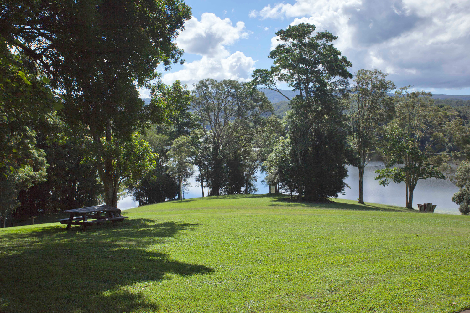
Rocky Creek Dam is a 29-square kilometre pristine catchment area supplying drinking water to the Northern Rivers area from Ocean Shores, west to Lismore and south to Woodburn.
The dam has a platypus viewing platform, elevated boardwalk and pontoon bridge. You might spot a platypus frolicking, a goanna sunbaking, or a flock of cockatoos flying overhead at dusk.
You can learn about the forest and water cycle by setting out from the picnic area on one of the four beautiful walks designed to provide diverse experiences of the rainforest reserve. Rocky Creek Dam is a perfect destination for families to enjoy a barbeque or picnic alongside the dam’s clear waters while the kids explore the adventure playground.
Location: Rocky Creek Dam Road, Dorroughby

“Wollumbin is just a beautiful place to be, with the view of an ancient volcano surrounded by Gondwana-age rainforest.” The ancient World Heritage-listed Gondwana Rainforests of Wollumbin National Park are reminiscent of a time when rainforests covered much of Australia.
The area is one of Australia’s biodiversity hotspots with abundant flora and fauna, including the rare and endangered Albert’s Lyrebird. Dual named Wollumbin-Mount Warning is the central plug of a huge, extinct shield-shaped volcano.
Wollumbin is the Aboriginal name and Captain Cook named it Mount Warning in 1770 to warn mariners of offshore reefs. 20 million years of heavy rainfall has shaped the area, also known as ‘The Green Cauldron’. Walk through the rainforest to appreciate the bountiful wildlife. Under Bundjalung lore, only chosen people can climb Wollumbin. As a sign of respect to their Ancestors, Bundjalung people ask that you choose not to climb.
Wollumbin, which dramatically rises from World Heritage-listed Wollumbin National Park – formerly known as Mount Warning National Park – to a height of 1,157m above sea level, is a remnant central vent of an ancient volcano. This spectacular feature can be viewed from a range of vantage points in the surrounding massive crater (caldera), including Cudgen Nature Reserve, Border Ranges National Park and Nightcap National Park, Cape Byron lighthouse and various settlements.
Explore this exquisite Gondwana Rainforest of Australia – rich in plant, bird and animal life – by taking a short walk on Lyrebird track. Hike this winding path under towering palms listening out for the calls of whipbirds, noisy pitta and, of course, lyrebirds. Enjoy a picnic beside Breakfast Creek or at Korrumbyn picnic area.
For opening times, fees, weather & climate information, maps and up to date access and road conditions see the National Parks website here.
96kms north west of Lismore
> Lyrebird track
Content and image provided by 'NSW National Parks and Wildlife Service'.